Weather vs. Climate: The Key Difference
Weather describes the state of the atmosphere at a specific time and place — today's temperature, tonight's rain. Climate, on the other hand, is the statistical average of weather over 30 or more years. When meteorologists say "above-normal temperatures," they mean compared to the 30-year climate average for that location and date. Climate patterns are the large-scale oscillations that tilt the odds toward certain weather outcomes across entire regions and seasons.
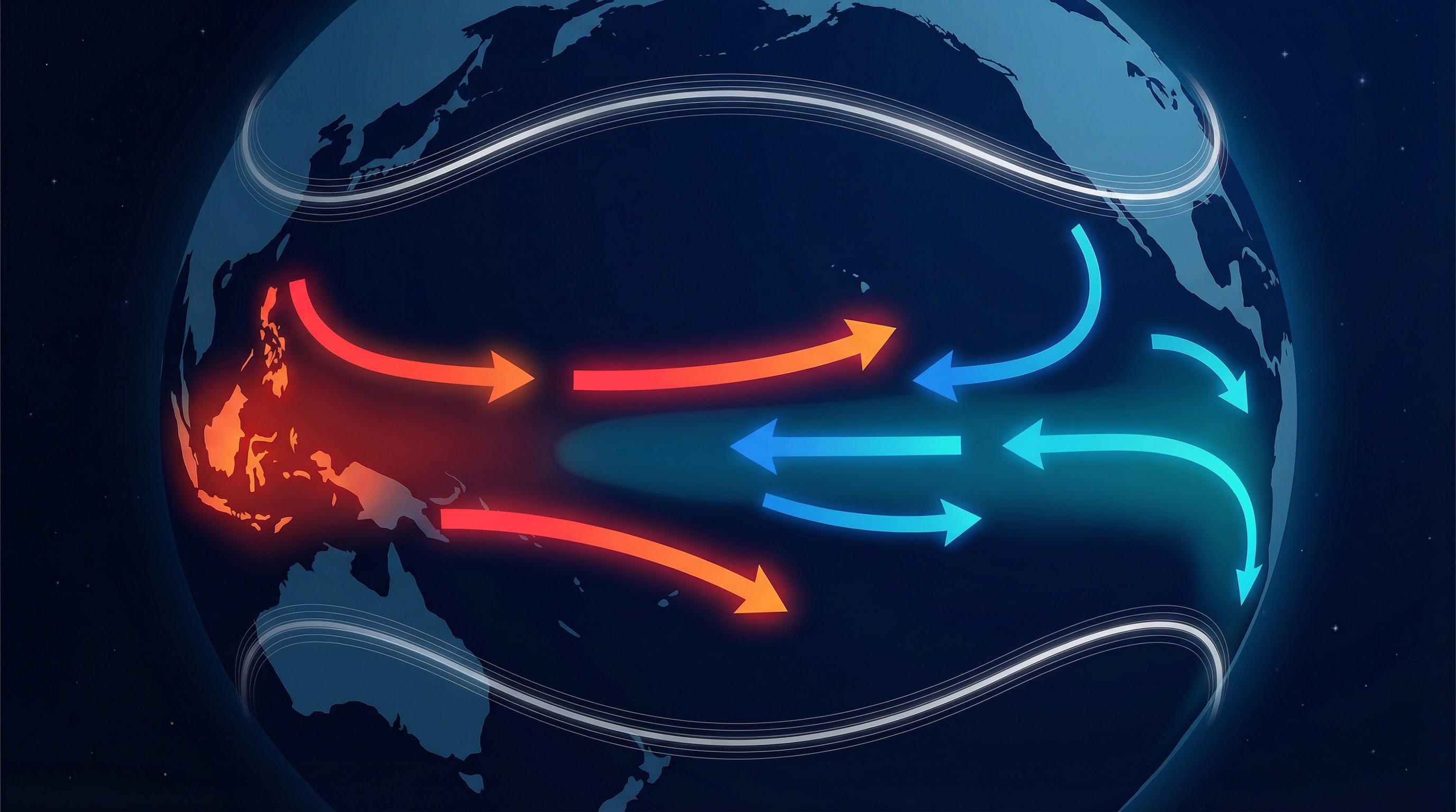
El Nino and La Nina (ENSO)
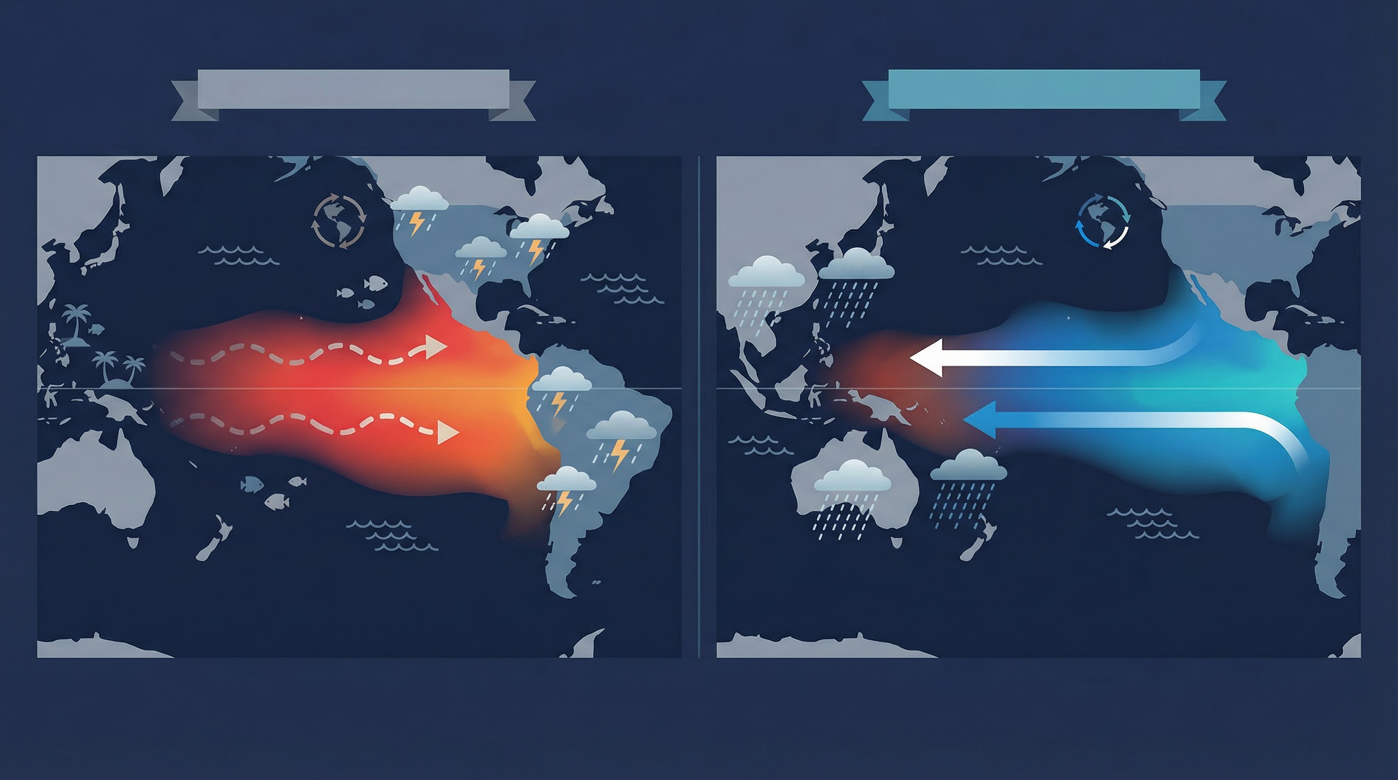
The El Nino-Southern Oscillation (ENSO) is the most influential climate pattern on Earth. It describes a recurring cycle of warming (El Nino) and cooling (La Nina) of sea surface temperatures in the central and eastern tropical Pacific Ocean, typically lasting 9–12 months.
During El Nino, warmer-than-normal Pacific waters shift rainfall patterns eastward, bringing heavier rains to the western Americas, drought to Australia and Southeast Asia, and generally warmer global temperatures. Strong El Nino events have been associated with destructive flooding in Peru and Ecuador, coral bleaching in the Pacific, and milder winters in northern North America.
During La Nina, the opposite occurs — cooler-than-normal Pacific waters strengthen trade winds, enhancing rainfall in Southeast Asia and Australia while bringing drier conditions to the American Southwest. La Nina years are associated with more active Atlantic hurricane seasons, colder winters in the northern United States, and increased flooding in Bangladesh and eastern Australia.
ENSO events are monitored using the Oceanic Nino Index (ONI), which measures sea surface temperature anomalies in the Nino 3.4 region. An ONI above +0.5°C for three consecutive months signals El Nino; below -0.5°C signals La Nina. ENSO forecasts extend up to 9 months ahead and are critical for agriculture, water management, and disaster preparedness worldwide.
The Jet Stream
The jet stream is a narrow band of fast-moving air (typically 100–200 mph) at about 30,000 feet altitude, flowing from west to east across the mid-latitudes. It acts as a boundary between cold polar air to the north and warm tropical air to the south. The jet stream's position determines which regions experience warm or cold weather — when it dips southward (a trough), it pulls cold air with it; when it bulges northward (a ridge), it allows warm air to push poleward.
The jet stream also steers storm systems. Low-pressure systems (storms) tend to form along and travel with the jet stream. When the jet stream is strong and relatively straight (a "zonal" pattern), weather systems move quickly and extreme conditions are less persistent. When the jet stream becomes wavy (a "meridional" pattern), weather patterns can stall — leading to prolonged heat waves, cold snaps, or flooding events. Research suggests that Arctic warming may be making the jet stream wavier, contributing to more extreme and persistent weather events in mid-latitude regions.
Monsoons
Monsoons are seasonal reversals of wind direction driven by the different heating rates of land and ocean. The most well-known is the South Asian monsoon, which brings about 70–80% of India's annual rainfall between June and September. As the Indian subcontinent heats up in summer, moist air from the Indian Ocean is drawn inland, producing intense rainfall.
Monsoon patterns also exist in West Africa, East Asia, Australia, and the American Southwest. The timing, intensity, and duration of monsoons have profound impacts on agriculture, water supply, and flood risk. In India alone, monsoon variability affects the livelihoods of over one billion people. Late or weak monsoons can cause drought and crop failure; early or excessive monsoons trigger devastating floods and landslides.
Other Major Climate Oscillations
- North Atlantic Oscillation (NAO): Controls winter weather across Europe and eastern North America. A positive NAO brings mild, wet winters to northern Europe and cold, dry conditions to the Mediterranean.
- Arctic Oscillation (AO): Closely related to the NAO. When the AO is negative, the polar vortex weakens, allowing bitter Arctic air to spill southward into lower latitudes — the phenomenon behind extreme cold outbreaks.
- Indian Ocean Dipole (IOD): A difference in sea surface temperatures between the western and eastern Indian Ocean. A positive IOD brings drought to Australia and enhanced rainfall to East Africa.
- Pacific Decadal Oscillation (PDO): A longer-term (20–30 year) pattern of Pacific temperature variability that modulates ENSO's effects and influences long-term drought and precipitation trends in North America.
Climate Change and Shifting Patterns
Human-driven climate change is superimposing long-term warming trends onto natural climate variability. Global average temperatures have risen approximately 1.2°C since the pre-industrial era, and each decade since the 1980s has been warmer than the last. This warming intensifies natural patterns — El Nino events occur on top of an already-warmer baseline, heat waves become more frequent and severe, and extreme rainfall events intensify because warmer air holds about 7% more moisture per degree Celsius of warming (the Clausius-Clapeyron relation).
Climate models project that by 2050, many regions will experience significantly altered weather patterns: more intense but potentially less frequent tropical cyclones, expanded drought zones, shrinking snowpack, and shifting agricultural growing seasons. Monitoring current conditions through tools like Weather World AI helps communities track these changes in real time and adapt accordingly.
Explore current conditions
See how these patterns play out in real time on our Global AQI Map and City Rankings.
Weather World AI Editorial Team
This article was written and reviewed by our core team of meteorology enthusiasts and environmental health researchers. We rely on open, government-backed data sources (like NOAA and ECMWF) and adhere to strict editorial standards to ensure our weather, climate, and air quality information is accurate, up-to-date, and actionable.